
About Cote d'Ivoire (Ivory Coast)
French - the sole official language, a legacy of colonial rule.
Dioula - the most widely spoken of 60+ native dialects, serving as a trade language.
Baoule, Dan, Anyin, and Cebaara Senufo are also widely spoken; around 78 distinct languages are spoken across the country's more than 60 ethnic groups.
French is the sole official language of Cote d'Ivoire.
| Geography |
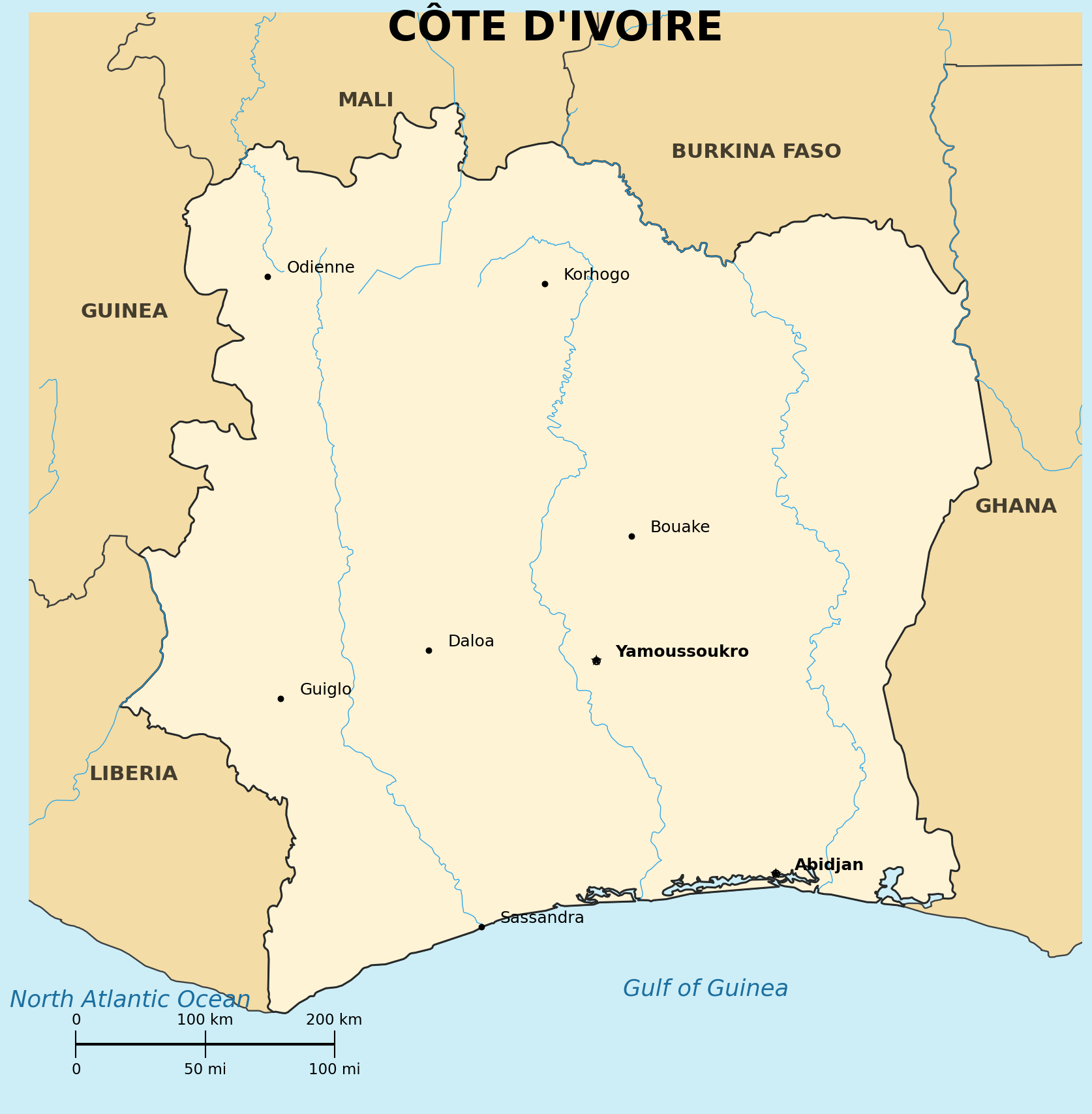
Location: Western Africa, bordering the North Atlantic Ocean, between Ghana and Liberia
Map references: Africa
Area:
total: 322,463 sq km
Land boundaries:
border countries: Burkina Faso, Ghana, Guinea, Liberia, Mali
Geography - note: the name means "Ivory Coast" in French, reflecting the region's ivory trade from the 15th-17th centuries; the French version has been used internationally since 1986, at the country's request
| People |
Population: 26.4-33.5 million (varies significantly by source; 2023-2025 est.)
Nationality:
noun/adjective: Ivoirian(s)
Ethnic groups: Akan 38%, Voltaique/Gur 22%, Northern Mande 22%, Kru 9.1%, Southern Mande 8.6% (2021 est.); more than 60 ethnic groups total, the Akan being the largest, inhabiting the central region
Religions: large populations of Muslims, Christians (primarily Roman Catholic), and adherents of various indigenous religions
Languages: French (official), 60 native dialects (Dioula most widely spoken); around 78 distinct languages spoken overall
Literacy: total population 50% (male 60.2%, female 40.3%) (2021 est.)
Population distribution: most inhabitants live along the sandy coastal region; apart from the capital area, the forested interior is sparsely populated
| Government |
Country name:
conventional long form: Republic of Cote d'Ivoire
conventional short form: Cote d'Ivoire (Ivory Coast)
Data code: IV
Government type: presidential republic
National capital: Yamoussoukro (legislative capital); Abidjan (administrative and economic capital, and the largest city)
Administrative divisions: 12 districts and 2 autonomous districts
Independence: 7 August 1960 (from France)
Background: between the 14th-17th centuries, Cote d'Ivoire was a significant player in trans-Saharan trade, with Akan empires facilitating trade in gold, ivory, and kola nuts; became a French protectorate in 1893; has experienced periods of political instability in the late 20th and early 21st centuries, particularly civil conflict in the 2000s and 2010s
| Economy |
Economy - overview: rapidly developing West African economy; one of the world's leading producers of cocoa and cashew nuts, playing a significant role in the global agricultural market; driven by agriculture and increasing foreign investment
Unemployment rate: 2.3% (2025 est.)
Currency: West African CFA franc (XOF)
| Military |
Military branches: Armed Forces of Cote d'Ivoire (FACI): Army, National Navy, Air Force, Special Forces; National Gendarmerie; Ministry of Security: National Police (2025)