
Country information
South Sudan
- Capital
- Juba
- Population
- 12,000,000
Languages spoken
About South Sudan
English - the official language, used in government, education, and business.
Juba Arabic - an Arabic-based creole widely used as a lingua franca, especially in Juba and other towns.
Dinka - the largest indigenous language, spoken by about a third of the population.
Nuer, Bari, Zande, Shilluk, Otuho, and more than 60 other indigenous languages are spoken and recognized as national languages.
English is the official language of South Sudan.
| Geography |
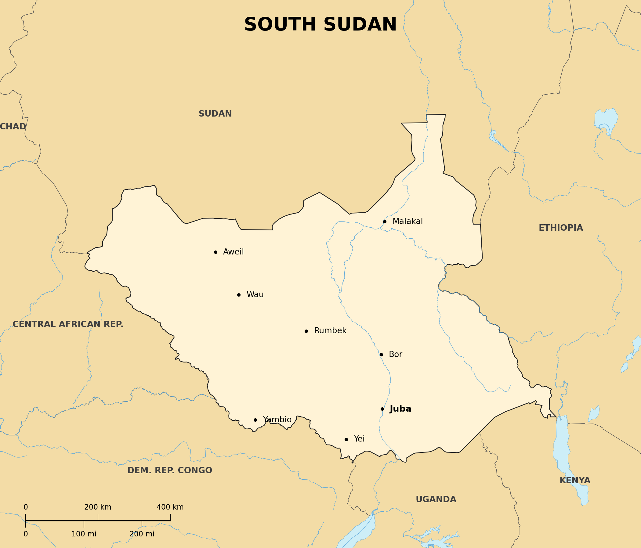
Location: East-Central Africa; landlocked
Map references: Africa
Area:
total: 644,329 sq km
Land boundaries:
border countries: Central African Republic, Democratic Republic of the Congo, Ethiopia, Kenya, Sudan, Uganda
Climate: hot with seasonal rainfall; rainy season from May to October
Terrain: plains in the north and center, including the vast Sudd swamp of the White Nile; highlands along the Ugandan and Kenyan borders
| People |
Population: about 12-16 million (2024 est.)
Nationality:
noun: South Sudanese
adjective: South Sudanese
Ethnic groups: Dinka about 36%, Nuer about 16%, Shilluk, Azande, Bari, Kakwa, Kuku, Murle, Mandari, Didinga, and others
Religions: Christian about 60%, traditional African religions, Muslim
Languages: English (official), Juba Arabic, Dinka, Nuer, Bari, Zande, Shilluk, and many others
| Government |
Country name:
conventional long form: Republic of South Sudan
Data code: SS
Government type: presidential republic
National capital: Juba
Independence: 9 July 2011 (from Sudan)
Background: After decades of civil war between the government in Khartoum and southern rebels, a 2005 peace agreement led to a 2011 referendum in which about 99% of southerners voted for independence; South Sudan is the world's newest widely recognized country, but it has since suffered civil conflict and humanitarian crises