
Country information
Eritrea
- Capital
- Asmara
- Population
- 3,607,000
Languages spoken
About Eritrea
Tigrinya - the most widely spoken official language, spoken by ~50% of the population.
Arabic and English - also official languages.
Tigre (~30%), Saho, Kunama, Afar, Bilen, Nara, and Beja are also spoken, representing Eritrea's nine recognized ethnic groups.
Tigrinya, Arabic, and English are the three official languages of Eritrea, alongside several recognized national languages.
| Geography |
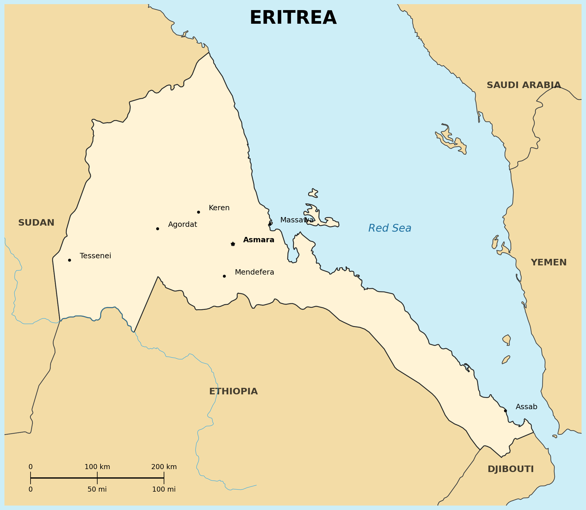
Location: Eastern Africa, bordering the Red Sea, between Djibouti and Sudan
Map references: Africa
Area:
total: 117,600-120,000 sq km
Land boundaries:
border countries: Djibouti, Ethiopia, Sudan
Natural hazards: frequent droughts; rare earthquakes and volcanoes; locust swarms; Nabro volcano (2,218 m) erupted in 2011
Geography - note: strategic geopolitical position along some of the world's busiest shipping lanes
| People |
Population: estimates range widely, from 3.6 to 6.7 million; Eritrea has never conducted an official government census (2024-2025 est.)
Age structure:
0-14 years: 38.23%
65 years and over: 4% (2022 est.)
Life expectancy at birth:
total population: 66.85 years
male: 64.25 years
female: 69.53 years
Infant mortality rate: 41.5 deaths/1,000 live births
Nationality:
noun/adjective: Eritrean(s)
Ethnic groups: Tigrinya 50%, Tigre 30%, Saho 4%, Afar 4%, Kunama 4%, Bilen 3%, Hedareb/Beja 2%, Nara 2%, Rashaida 1% (2021 est.; nine recognized ethnic groups)
Religions: Islam ~53% (mostly Sunni), Christianity ~46% (Eritrean Orthodox, Roman Catholic, Evangelical Lutheran)
Languages: Tigrinya (official), Arabic (official), English (official), Tigre, Kunama, Afar, other Cushitic languages
Literacy: total population approximately 74% (2015 est.); literacy rate has doubled over the past two decades through successful adult education programs
Population distribution: density highest in the center of the country, around the capital, Asmara, and Keren; smaller settlements exist in the north and south
| Government |
Country name:
conventional short form: Eritrea
Data code: ER
Government type: unitary one-party presidential republic under a totalitarian dictatorship
National capital: Asmara
Executive branch:
chief of state and head of government: President Isaias Afwerki (Eritrea's only president since independence)
Background: won independence from Italian colonial control in 1941; the UN established it as an autonomous region within the Ethiopian federation in 1952; Ethiopia's full annexation as a province in 1962 sparked a violent 30-year war for independence, ending in 1991 with Eritrean fighters defeating government forces; independence was overwhelmingly approved in a 1993 referendum; Isaias Afwerki's rule, particularly since 2001, has been marked by highly autocratic and repressive governance, including indefinite mandatory national conscription
| Economy |
Economy - overview: largely agrarian, command economy with a significant mining sector, controlled by the sole political party (People's Front for Democracy and Justice); a persistently poor country; nearly 80% of the population engages in subsistence agriculture; a substantial fiscal surplus exists due to tight government control, alongside high vulnerable debts and significant data integrity challenges
GDP (purchasing power parity): $2.534 billion (2024 est.)
GDP - real growth rate: variable, historically around 1.9-5% (2016-2017 range cited)
Currency: Eritrean nakfa (ERN)
| Military |
Military branches: Eritrean Defense Forces (EDF): Ground Forces, Navy, Air Force; People's Militia (2024)
Military service age and obligation: mandatory for all citizens ages 18-40; 18-month conscript obligation officially, though often extended indefinitely in practice (2024)
| Transnational Issues |
Trafficking in persons - tier rating: Tier 3 (2025)