
Country information
Sierra Leone
- Capital
- Freetown
- Population
- 9,077,691
Languages spoken
About Sierra Leone
English - the official language, though its regular use is limited to a literate minority.
Krio - an English-based Creole spoken by descendants of freed Jamaican and African American settlers; a first language for about 10% of the population but understood by 95%, serving as the country's lingua franca.
Mende - the principal vernacular in the south.
Temne - the principal vernacular in the north.
English is the sole official language of Sierra Leone.
| Geography |
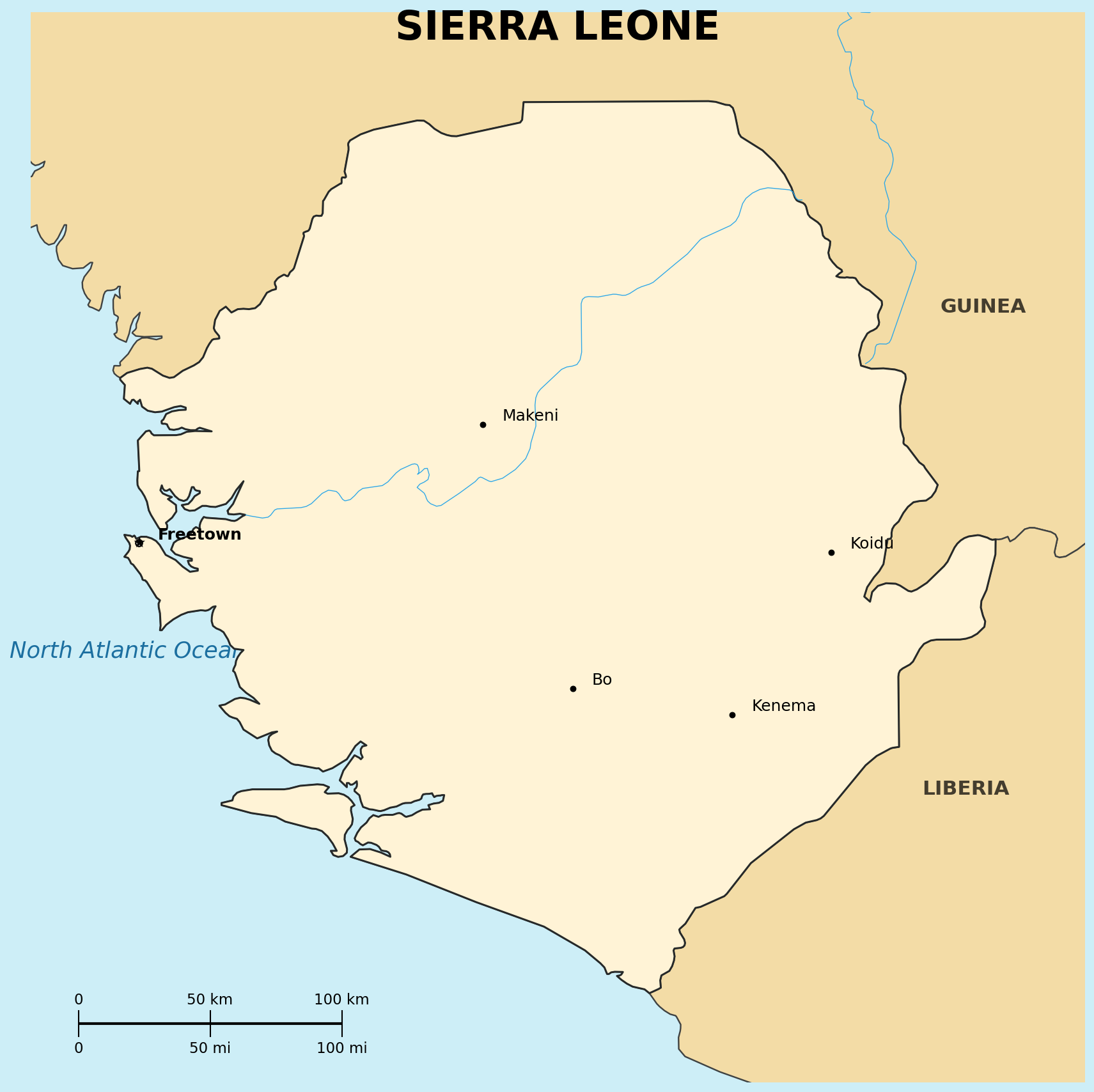
Location: Western Africa, bordering the North Atlantic Ocean, between Guinea and Liberia
Map references: Africa
Area:
total: 71,620-73,252 sq km
Land boundaries:
border countries: Guinea, Liberia
Terrain: coastal belt of mangrove swamps, wooded hill country, upland plateau, mountains in the east
| People |
Population: 8.46-9.33 million (2023-2025 est.)
Age structure:
0-14 years: 40.1%
15-64 years: 57.4%
65 years and over: 2.5% (2024 est.)
Median age: 19.7 years (2025 est.)
Nationality:
noun/adjective: Sierra Leonean(s)
Ethnic groups: over a dozen ethnic groups; Temne and Mende are the largest, together accounting for a significant portion of the population
Religions: Muslim approximately 60%, Christian approximately 30%, with traditional beliefs also practiced
Languages: English (official, regular use limited to a literate minority), Mende (principal vernacular in the south), Temne (principal vernacular in the north), Krio (English-based Creole, first language for 10%, understood by 95%)
Literacy: total population 43.6% (male 54.6%, female 33.9%) (2019 est.)
Population distribution: clusters found in the lower elevations of the south and west; the northern third of the country is less populated
| Government |
Country name:
conventional long form: Republic of Sierra Leone
conventional short form: Sierra Leone; Portuguese explorer Pedro de Sintra is usually credited with naming the country "Serra da Leao" (Lion Mountains) in 1462
Data code: SL
Government type: presidential republic
National capital: Freetown; the name described the original 1781 settlement, which served as a haven for free-born and freed African Americans
| Economy |
Economy - overview: low-income, least-developed West African economy; primarily subsistence agriculture; key iron and diamond mining activities have been suspended in recent years; slow recovery from the 1990s civil war; systemic corruption, high-risk debt, and high youth unemployment persist despite significant natural resource wealth
GDP (purchasing power parity): $32.51 billion (2025 est.)
GDP - real growth rate: 4.7% (2025)
GDP - per capita: $3,550 PPP (2025 est.)
Inflation rate: 16.862% (2018 est.)
Population below poverty line: 52.9% (2011)
Currency: Sierra Leonean leone (SLE)
| Military |
Military branches: Republic of Sierra Leone Armed Forces (RSLAF), organized as a Joint Force Command with land, air, and maritime components; primary responsibilities include securing borders and territorial waters, supporting civil authorities during emergencies, and participating in peacekeeping missions; has received assistance from Canada, China, France, the UK, and the US since the end of the civil war in 2002 (2025)